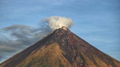
From the gentle whisper of a morning breeze to the devastating power of a cyclone, winds, storms, and cyclones shape our weather and our world.
This article unpacks the science behind these phenomena, exploring air pressure, wind currents, thunderstorm formation, cyclone safety, and how technology is helping keep us safe.
The Unseen Force: How Air Exerts Pressure
What is Air Pressure?
Air may seem invisible, but it has weight and occupies space. The Earth’s atmosphere is a vast layer of gases, and every molecule of air is constantly pulled down by gravity.

Air pressure, or atmospheric pressure, is the force exerted by the weight of air molecules on everything at the Earth’s surface. Think of it as an invisible hand pressing on all objects, including us, from all directions.
A Simple Analogy: The Column of Air
Imagine standing at sea level, with a column of air extending above your head all the way to the top of the atmosphere.
This column of air, although invisible, weighs about 1 kilogram per square centimeter. That’s equivalent to the weight of a liter of milk pressing down on an area the size of a fingernail! Yet, because this pressure is equal in all directions, we don’t feel crushed.
Everything from the way our lungs work to the weather above us is influenced by this fundamental property of air.
The Bernoulli Principle in Action: High-Speed Winds and Reduced Air Pressure
Linking Wind Speed to Pressure
What causes wind? The answer lies in differences in air pressure. When air moves from a high-pressure area to a low-pressure area, wind is formed.
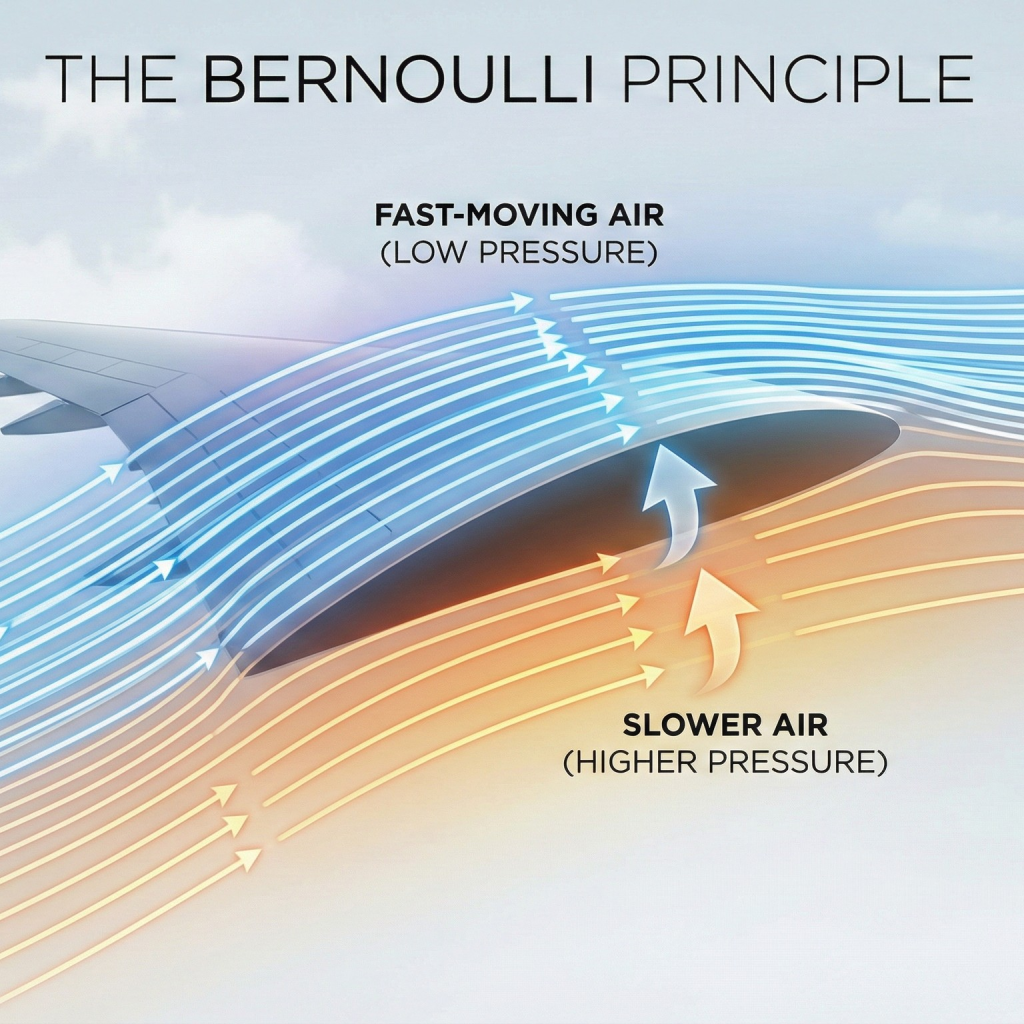
But there’s more: tells us that as the speed of a fluid (like air) increases, its pressure decreases.
This elegantly explains why high-speed winds are accompanied by reduced air pressure crucial driver for many weather phenomena.
Real-World Examples: From Airplane Wings to Thatched Roofs
The principle is at play in our daily lives. For example, airplane wings are curved on top and flat underneath.
As air moves faster over the top surface, lower pressure is created, generating lift and allowing planes to fly.
In severe storms, high winds blowing over a thatched roof can create such low pressure above the roof that the higher pressure inside the house can literally lift the roof off! This is why storm-resilient construction is so important in cyclone-prone areas.
The Power of Heat: Why Air Expands on Heating
Molecules in Motion
Everything about weather starts at the molecular level. Air is made up of molecules, tiny particles that move rapidly.
When air is heated, its molecules gain energy, moving faster and spreading further apart.
This causes the air to expand, making it lighter and less dense. This scientific principle is why hot air balloons rise: the heated air within the balloon is lighter than the cooler air outside.
How Heating Creates Low-Pressure Zones
As air expands and becomes less dense, it exerts less pressure on the surface below. This creates what meteorologists call a low-pressure zone.
Since nature dislikes imbalance, cooler, denser air from surrounding areas rushes in to fill the gap, setting up the fundamental mechanism behind wind currents.
This continuous dance of heated, rising air and cooler, sinking air is what drives the planet’s weather engine.
The Planet’s Engine: How Uneven Heating Generates Wind Currents
Global Wind Patterns: Equator vs. Poles
The uneven heating of the Earth’s surface by the sun is the masterstroke behind wind formation. The equator receives more direct sunlight and thus warms up much more than the poles.
As air over the equator heats up, it becomes lighter and rises, creating a belt of low pressure. Cooler, heavier air from the poles rushes toward the equator, replacing the rising air and creating global wind patterns like the trade winds, westerlies, and polar easterlies.
These massive movements of air are further influenced by the Earth’s rotation (the Coriolis effect), causing the winds to curve and creating complex wind belts around the planet.
The interaction of these global wind patterns is responsible for major weather systems, including tropical cyclones and monsoons.
Local Winds: Sea Breeze and Land Breeze
It’s not just a global phenomenon, uneven heating also creates local wind systems. Take the sea breeze: during the daytime, land heats up faster than water.
The hot air above the land rises, and cooler air from the sea rushes in to take its place, creating a refreshing sea breeze. At night, the process reverses: the land cools faster than the sea, and now air moves from land to sea in what’s known as a land breeze.
These examples of wind currents from planetary to local are essential in shaping climate zones, distributing moisture, and even influencing where storms are most likely to form.
Nature’s Fury: The Formation of Thunderstorms and Cyclones
How a Thunderstorm Forms
A thunderstorm is one of nature’s most dynamic displays, born from rapidly rising air. When the sun heats the Earth’s surface, the warm, moist air rises quickly into the cooler atmosphere.
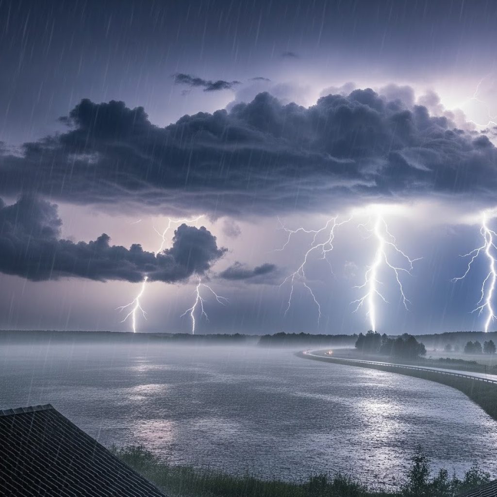
As it rises, the moisture condenses, forming towering clouds called cumulonimbus. The process releases latent heat, fueling further rise and cloud growth.
The rapid upward and downward movement of air generates powerful updrafts and downdrafts, leading to thunder, lightning, and often heavy rainfall—classic signs of a full-fledged thunderstorm.
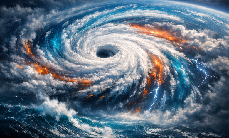
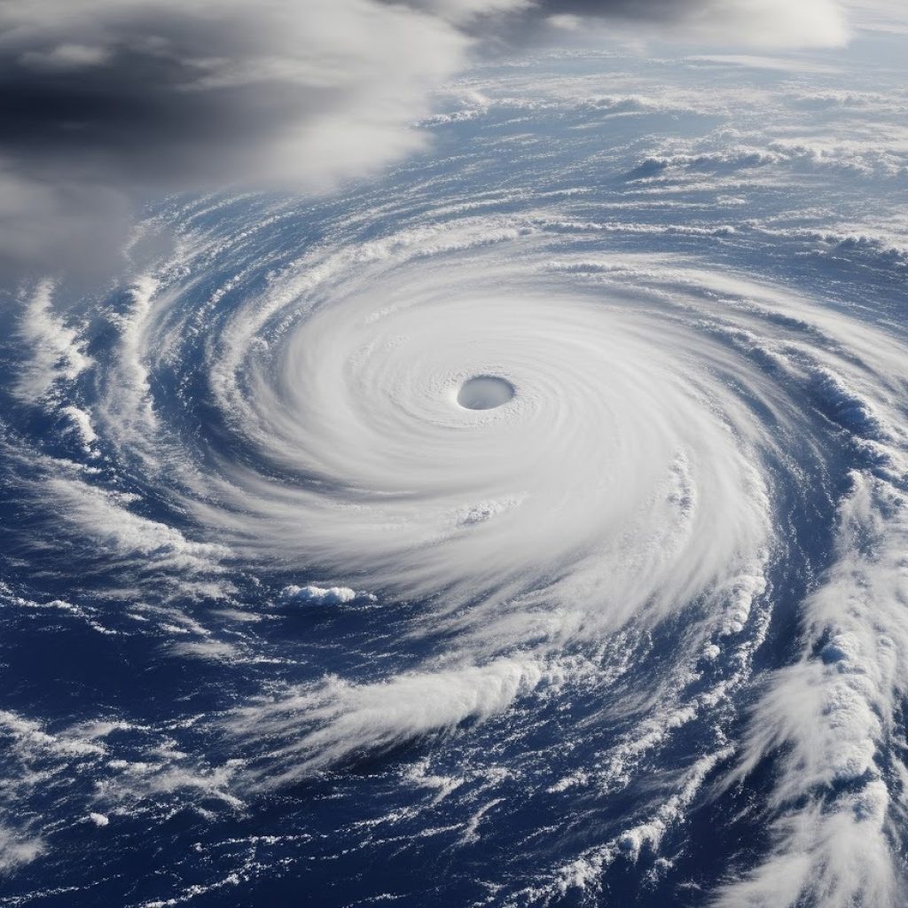
The Birth of a Cyclone: A Step-by-Step Process
Cyclones, also known as hurricanes or typhoons depending on the region, are among the most intense storms on Earth. How does cyclone formation occur?
- Warm Ocean Water: The process typically starts over warm tropical oceans (with temperatures above 27°C). The heat from the ocean causes massive evaporation, saturating the air with moisture.
- Rising Air: This warm, moist air rises, creating a low-pressure zone at the surface. As it rises, the air cools, and the water vapor condenses to form clouds and release heat, which fuels further uplift.
- Development of a Cyclone: The rising air draws in more warm, moist air, while cooler air sinks in the surrounding regions. Due to Earth’s spin, the system begins to rotate—it takes on a spiral structure with winds rotating around a central core. When wind speeds reach 62 km/h, it’s classified as a tropical storm; at 119 km/h, it’s a cyclone.
Understanding the “Eye” of the Cyclone
At the center of every well-developed cyclone lies the eye—a relatively calm, clear area typically 20-50 km across.
The eye forms as air spirals inward and upward around the center but descends at the very center, creating still, clear conditions. Ironically, while the eye is calm, it’s surrounded by the most violent winds and rain bands of the entire storm, known as the eyewall.
The Aftermath: Understanding the Destruction Caused by Cyclones
The Triple Threat of a Cyclone
Cyclones bring a deadly combination of forces that can cause devastation over vast areas. Understanding the specifics of cyclone dangers is essential for effective cyclone safety and preparedness efforts.
- High-Velocity Winds: The spiraling winds of a cyclone can reach speeds exceeding 200 km/h. These winds uproot trees, damage buildings, tear apart power lines, and transform debris into dangerous missiles. Homes, especially poorly constructed ones, can be flattened, and vital infrastructure paralyzed in minutes.
- Storm Surge: Perhaps the most lethal aspect is the storm surge. As a cyclone nears land, strong winds push ocean water towards the shore, creating a rapidly rising wall of water that floods coastal areas. Storm surges have been responsible for the largest death tolls in cyclone history, obliterating villages and farmland and contaminating freshwater supplies.
- Torrential Rains and Flooding: Cyclones carry immense amounts of moisture, dumping it as torrential rain over wide areas. Rivers and lakes can quickly overflow, causing flash floods and landslides. Besides immediate loss of life, prolonged flooding leads to disease outbreaks and crop loss, further affecting communities long after the cyclone has passed.
Your Guide to Safety: Effective Measures Against Cyclones
Before the Cyclone: Preparation is Key
Good preparation can dramatically reduce the harm caused by cyclones. Here are essential cyclone safety tips:
- Stay informed by following cyclone updates from official weather channels and weather forecasting technology.
- Strengthen your home—secure windows, reinforce doors, and ensure your roof is firmly attached.
- Prepare an emergency kit with water, non-perishable food, medications, torchlights, batteries, and copies of important documents.
- Identify the nearest cyclone shelters and safe evacuation routes, especially if you live near the coast.
During the Cyclone: Staying Safe Indoors or Evacuating
Your safety during a cyclone depends on quick, informed decisions:
- Follow evacuation orders promptly if authorities issue them—do not delay.
- If staying indoors, move to the strongest part of your house, keep away from windows, and close all doors and windows securely.
- Keep your emergency kit and battery-powered radio within reach. Stay tuned to official updates.
- Avoid using electrical appliances and stay away from power lines or waterlogged areas to prevent electrocution.
After the Cyclone: Navigating the Recovery
The aftermath of a cyclone can be chaotic and hazardous. Take the following steps:
- Wait for official confirmation that it is safe before leaving your shelter.
- Avoid floodwaters—they may conceal debris, open manholes, or electric lines.
- Help others who may be injured or stranded, especially children, the elderly, and the disabled.
- Stay alert for additional dangers, like broken gas lines, unstable structures, or mosquito-borne diseases.
Our Technological Shield: How Advanced Technology Has Helped
Eyes in the Sky: Satellites and Radars
Modern weather forecasting technology has revolutionized our ability to monitor and prepare for winds, storms, and cyclones.

Weather satellites orbiting Earth provide continuous, real-time images of cloud formations, measure ocean temperatures, and track the growth of potential cyclones. Ground-based Doppler radars scan for rain, wind speed, and storm rotation, giving scientists crucial information about storm development and movement.
Predicting the Path: Supercomputers and Weather Models
Today’s supercomputers run advanced weather models, which assimilate vast amounts of data from satellites, buoys, radars, and weather stations to simulate the complex behavior of the atmosphere.
These models predict where a cyclone will form, how strong it might become, and where it will make landfall with increasing accuracy. Improved models mean more reliable warnings and better disaster management.
Timely Alerts: The Importance of Cyclone Warning Systems
An effective cyclone warning system is a vital shield for vulnerable populations. With early warning, governments can organize evacuations, fishermen can return to shore, and communities have time to seek shelter.
Smartphone alerts, radio broadcasts, and community sirens combined with local awareness save countless lives each year. Technology continues to close the gap between detection and action, ensuring safety for millions.
Conclusion: From Air Pressure to Preparedness
From understanding air pressure and wind currents to harnessing advanced weather forecasting, humanity is better equipped than ever to face the challenges of winds, storms, and cyclones. Knowledge and preparedness, coupled with technology, form our best defense—helping to save lives and minimize damage when nature unleashes its power.